Unveiling The Iranian Plateau: Where Ancient History Meets Rugged Beauty
The Iranian Plateau, also known as the Persian Plateau, is far more than just a geographical feature; it is a vast, complex, and historically rich expanse that has profoundly shaped the destiny of one of the world's most ancient civilizations. Often misunderstood or overlooked, understanding where the plateau of Iran truly lies and what defines it is key to appreciating the unique character of this pivotal region in West Asia. From its dramatic geological formation to its role as a cradle of human civilization, the Iranian Plateau stands as a testament to the powerful interplay between nature and human history.
This comprehensive guide delves deep into the geographical, geological, and historical dimensions of the Iranian Plateau, exploring its boundaries, diverse landscapes, and the significant impact it has had on human migration and cultural development. Join us as we journey through this remarkable land, uncovering the secrets of its rugged mountains, arid basins, and the enduring spirit of its people.
Table of Contents
- What is the Iranian Plateau? A Geological Perspective
- Geographical Extent and Defining Boundaries
- A Land of Contrasts: Climate and Landscape
- The Majestic Mountain Ranges: Guardians of the Plateau
- The Central Basins: Iran's Arid Heart
- Geological Dynamics: A Shifting Landscape
- A Cradle of Civilization: The Iranian Plateau's Historical Significance
- The Iranian Plateau's Enduring Legacy
What is the Iranian Plateau? A Geological Perspective
The Iranian Plateau, frequently referred to as the Persian Plateau, is fundamentally a geological feature. It is not merely a flat expanse but a complex tectonic entity that forms an integral part of the Eurasian Plate. Its unique position is defined by its being wedged between two colossal tectonic forces: the Arabian Plate to the southwest and the Indian Plate to the southeast. This immense geological pressure has sculpted a landscape of dramatic contrasts, characterized by towering mountain ranges, vast interior basins, and diverse ecological zones.
This geological formation spans an impressive area, encompassing parts of the Caucasus, Central Asia, South Asia, and West Asia. While the term "Iranian Plateau" might suggest it is entirely within modern-day Iran, its geological boundaries extend far beyond, making it a significant trans-regional feature. It is this dynamic geological setting that dictates much of the region's physical geography, from its seismic activity to its varied elevations.
Geographical Extent and Defining Boundaries
To truly answer "where is the plateau of Iran?", one must understand its broad geographical reach and the natural barriers that define it. As a geological formation, the Iranian Plateau stretches across a vast territory, encompassing not only the majority of modern Iran but also extending into neighboring countries. Historically, as a region, it has included areas such as Parthia, Media, and Eastern Persia, which formed the heartlands of Greater Persia, primarily encompassing Iran, Afghanistan, and the parts of Pakistan west of the Indus River.
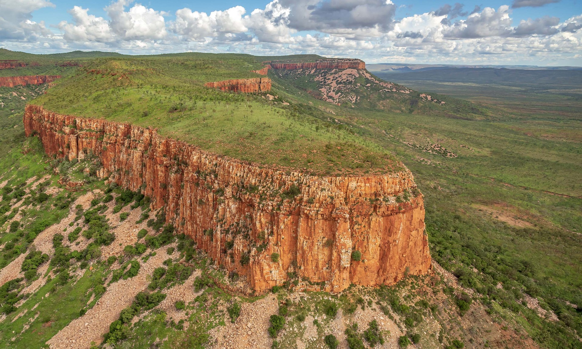
The boundaries of this immense plateau are marked by distinct geographical features. To the west, it is bordered by the formidable Zagros Mountains, which separate it from the Mesopotamian plains. To the north, the Caspian Sea and the Kopet Dag mountain range form a natural barrier. In the northwest, the Armenian Highlands and the Caucasus Mountains delineate its extent. To the south, the Strait of Hormuz and the Persian Gulf mark its edge, while to the east, a series of ranges collectively known as the Eastern Iranian Highlands complete its perimeter. This ring of mountains creates a high interior basin, which is the defining characteristic of the central and eastern portion of the plateau of Iran.
A Land of Contrasts: Climate and Landscape
The Iranian Plateau exhibits a continental climate, characterized by cold winters and hot summers, a stark contrast to its lush coastal fringes. The interior experiences significant temperature fluctuations between seasons and even between day and night. Winter rain and snow are crucial for the plateau's water supply, providing an annual precipitation of about 15 inches (38 centimeters) in the west, which gradually decreases to a meager 5 inches (13 centimeters) in the east. This dramatic variation in precipitation creates vastly different landscapes across the plateau.
In sharp contrast to the arid interior are the coastal regions that lie outside the mountain ring. For instance, in the north, a strip of land approximately 400 miles (650 km) long bordering the Caspian Sea, and never more than a narrow band, receives significantly higher rainfall, supporting dense forests and agricultural activity. The southern slopes of the Alborz mountains, which drop onto the central plateau of Iran, present a barren landscape, a stark difference from their lush northern counterparts. Trees are scarce here, found only along stream banks at the bottom of valleys, highlighting the challenging conditions of the plateau's interior.
The Majestic Mountain Ranges: Guardians of the Plateau
Iran is recognized as one of the world's most mountainous countries, and its landscape is overwhelmingly dominated by rugged mountain ranges that effectively separate the interior basins. These massive, heavily eroded mountain chains not only define the physical boundaries of the Iranian Plateau but also play a critical role in its climate, hydrology, and human settlement patterns. They act as formidable natural barriers, influencing everything from weather systems to historical trade routes.
The Elburz Mountains: Home to Damavand
Among the most prominent of these ranges is the Alborz (or Elburz) mountain chain, which arcs across northern Iran, forming a significant northern boundary for the plateau. This range is home to Mount Damavand, an iconic peak that reaches an astounding 18,934 ft (5,771m). Damavand, a dormant volcano, is not only the highest peak in Iran but also the highest volcano in Asia, a truly majestic natural landmark. Its presence on the map is often marked by a distinctive yellow triangle, signifying its prominence and importance within the Elburz chain. The southern slopes of the Alborz drop sharply onto the central plateau of Iran, with the average elevation at the base of these mountains around 1500 meters, marking the transition from the high peaks to the expansive interior.
The Zagros and Eastern Iranian Highlands
To the west and south, the Iranian Plateau is bounded by the extensive Zagros Mountains, a range that stretches for hundreds of kilometers, creating a natural barrier that has historically influenced the movement of peoples and goods. These mountains are characterized by their rugged terrain and deep valleys. To the east, the plateau is defined by a series of ranges collectively referred to as the Eastern Iranian Highlands. These eastern ranges, while perhaps less famous than the Zagros or Alborz, are equally crucial in shaping the plateau's geography and climate. The northwestern Iranian Plateau, where the Pontic and Taurus mountains converge, presents a particularly rugged country with higher elevations, a more severe climate, and greater precipitation compared to the Anatolian Plateau, showcasing the varied topography even within the broader plateau region.
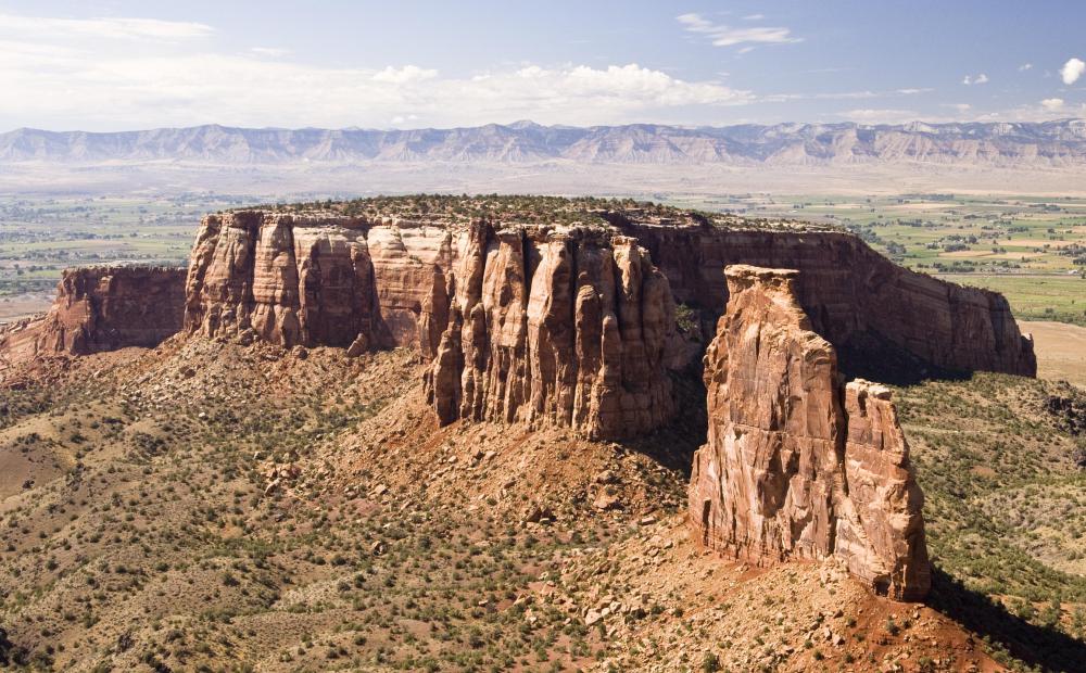
The Central Basins: Iran's Arid Heart
The heart of Iran consists of several closed basins, which collectively are referred to as the central plateau. This vast interior region is largely an endorheic drainage area, meaning its rivers and streams do not flow to the sea but instead terminate in inland lakes or evaporate. The average elevation of this plateau is approximately 900 meters (2,953 ft), providing a significant elevation compared to surrounding lowlands. However, several mountains that tower over the plateau exceed 3,000 meters (9,843 ft), creating dramatic variations in local topography.
These central basins are largely covered by deserts, the most famous of which are the Dasht-e Kavir (Great Salt Desert) and the Dasht-e Lut (Empty Desert). Except for some scattered oases, these deserts are largely uninhabited, presenting harsh and challenging environments. The extreme aridity and high temperatures in summer make these areas some of the most desolate on Earth. Despite their desolation, these basins are integral to the identity of the Iranian Plateau, showcasing its extreme environmental conditions.
Geological Dynamics: A Shifting Landscape
The central plateau of Iran is not merely a static landform; it is a dynamic tectonic plate that forms a basin surrounded by its tall, heavily eroded mountain ranges. This geological setting, being wedged between the Arabian and Indian plates, makes the region highly unstable. The immense pressure from these converging plates results in frequent earthquakes, a constant reminder of the powerful forces shaping the landscape. Numerical modeling and geological studies consistently suggest the ongoing tectonic activity beneath the Iranian Plateau, contributing to its rugged topography and seismic vulnerability.
This geological instability has profound effects on the people living on the plateau, influencing settlement patterns, infrastructure development, and even the availability of resources. The constant geological shifts contribute to the unique mineral deposits found in the region and dictate the flow of underground water, which is vital for the survival of communities in this arid environment. Understanding the geology is therefore crucial to comprehending the overall geography of Iran and how it affects its inhabitants, borders, climate, resources, and location.
A Cradle of Civilization: The Iranian Plateau's Historical Significance
Beyond its geological and geographical importance, the Iranian Plateau holds immense historical significance, having played a central role in human migration and the development of ancient civilizations. Its unique position and varied environments made it a crucial area for early human expansion and the emergence of complex societies.
A Population Hub for Early Humans
The Iranian Plateau may have played a major role in the expansion of modern humans after the "Out of Africa" migration. Evidence suggests it served as a "population hub" for "common Eurasians" around 50,000 years ago. From this pivotal location, these early human populations subsequently diverged into "ancient East Eurasians" and "ancient West Eurasians," from where they expanded in two waves during the initial Upper Paleolithic period. This theory highlights the plateau's strategic geographical position as a crossroads for human movement and genetic diversification, making the Iranian Plateau a crucial site in the story of human prehistory.
Heartland of Ancient Empires
As a historical region, the Iranian Plateau was the heartland of Greater Persia, encompassing the territories of modern-day Iran, Afghanistan, and western Pakistan. It was here that powerful ancient empires, such as the Achaemenid Empire, rose and flourished. The plateau's diverse geography, from fertile valleys to rugged mountains, provided both resources and natural defenses, contributing to the longevity and influence of these empires. The Achaemenid Empire, in particular, utilized the plateau's vastness and strategic location to establish one of the largest empires of the ancient world, demonstrating the profound historical impact of this geographical region.
The Iranian Plateau's Enduring Legacy
In conclusion, the Iranian Plateau, or Persian Plateau, is a geographical and geological marvel that defines much of West Asia. From its tectonic origins, wedged between the Arabian and Indian plates, to its dramatic mountain ranges like the Elburz and Zagros, and its vast, arid central basins, the plateau presents a landscape of profound contrasts and enduring beauty. Its continental climate, with its hot summers and cold winters, dictates the rhythm of life across its varied terrains.
More than just a physical space, the Iranian Plateau has been a crucible of human history, serving as a critical hub for early human migrations and the birthplace of some of the world's most influential ancient empires. Its rugged yet resourceful environment has shaped cultures, economies, and political destinies for millennia. Understanding where the plateau of Iran is, and appreciating its multifaceted nature, is essential to grasping the deep historical and geographical roots of this fascinating part of the world.
We hope this detailed exploration has shed light on the complexity and significance of the Iranian Plateau. Do you have any personal experiences or insights about this region? Share your thoughts in the comments below! If you found this article informative, please consider sharing it with others who might be interested in the geography and history of this incredible part of the world. For more deep dives into fascinating geographical features and their historical impact, stay tuned to our blog.
- 9xsarmy
- How Did Bloodhound Lil Jeff Die
- Julie Clapton
- Daisy From Dukes Of Hazzard Now
- Jameliz Onlyfans

Plateau | Definition, Geography, Landform, Types, & Examples | Britannica
What is a Plateau? (with pictures)
Quiz: How well do you know the world’s plateaus, mesas and buttes
