Unveiling Iran's Borders: A Geopolitical Journey
Iran, officially known as the Islamic Republic of Iran, is a nation strategically positioned in Western Asia, boasting an expansive territory of 1,648,195 square kilometers (636,372 square miles). Its unique geographical location at the crossroads of East and West, coupled with its diverse landscapes of plateaus, mountains, and vast desert zones, profoundly shapes its international relations and regional influence. Understanding the intricacies of Iran's borders is not merely an academic exercise; it is crucial for comprehending the country's geopolitical position and its significant influence in the Middle East and Central Asia.
This article delves deep into the fascinating world of Iran's bordering countries, exploring the lengths of these boundaries, the geographical features that define them, and the historical and cultural ties that bind Iran with its neighbors. From the rugged peaks of the Zagros Mountains to the serene waters of the Caspian Sea and the bustling shores of the Persian Gulf, Iran's frontiers tell a story of ancient civilizations, modern diplomacy, and a dynamic regional landscape. Join us as we navigate the extensive land and maritime borders that make Iran a key player on the global stage.
Table of Contents
- The Extensive Reach: Iran's Land and Sea Borders
- Iran's Western Gateways: Iraq and Turkey
- Northern Neighbors: Azerbaijan, Armenia, and Turkmenistan
- The Eastern Flank: Afghanistan and Pakistan
- Southern Maritime Frontiers: The Persian Gulf and Gulf of Oman
- Geopolitical Significance: Iran's Pivotal Position
- The Topographical Influence: Shaping Iran's Borders
- Cultural Exchange and Historical Intersections Across Borders
The Extensive Reach: Iran's Land and Sea Borders
Iran has international borders with 13 sovereign countries, both on land and sea, making it one of the most interconnected nations in the region. This extensive network of boundaries, totaling thousands of kilometers, highlights Iran's pivotal role in connecting various geopolitical spheres, from the Middle East to Central and South Asia. The sheer scale of these connections underscores the importance of understanding Iran's bordering countries.
The nation boasts a total of 5,894 kilometers (3,662 miles) of land borders, shared with seven distinct countries. These land neighbors are Iraq, Turkey, Azerbaijan, Armenia, Turkmenistan, Afghanistan, and Pakistan. Each of these borders presents unique geographical, historical, and geopolitical characteristics, contributing to the complex and dynamic regional landscape. Beyond its landmass, Iran's strategic location is further amplified by its significant maritime borders. With six neighboring coastal countries, Iran straddles a whopping 2,440 kilometers (1,520 miles) of coastline along vital waterways, including the Caspian Sea to the north and the Persian Gulf and the Gulf of Oman to the south.
This intricate web of land and sea connections means that Iran is bounded to the north by Azerbaijan, Armenia, Turkmenistan, and the Caspian Sea; to the east by Pakistan and Afghanistan; to the south by the Persian Gulf and the Gulf of Oman; and to the west by Turkey and Iraq. This comprehensive overview of Iran's bordering countries sets the stage for a more detailed exploration of each frontier, revealing the unique dynamics that shape Iran's regional interactions.
Iran's Western Gateways: Iraq and Turkey
To its west, Iran shares significant land borders with two pivotal nations: Iraq and Turkey. These western frontiers are not merely lines on a map but represent ancient pathways of trade, conflict, and cultural exchange that have profoundly influenced the history and development of the region. The relationship with these bordering countries is particularly complex, given shared histories and ongoing regional dynamics.
Iraq: A Complex and Enduring Border
The border between Iran and Iraq is one of the longest and most historically charged of all Iran's bordering countries. Stretching across varied terrain, this frontier has been the site of numerous conflicts and periods of cooperation. The physical map of Iran clearly shows the Zagros Mountains running along Iran's western borders, forming a natural barrier and influencing the demarcation of this boundary. The length of this border contributes significantly to Iran's total land border measurement, underscoring its strategic importance. The two nations share a complex history, marked by cultural similarities, religious ties, and periods of intense geopolitical tension, making the management of this border a continuous priority for both governments.
Turkey: A Strategic Nexus
Further to the north-west, Iran shares a border with Turkey. This border, while shorter than that with Iraq, is equally significant. Turkey, like Iran, serves as a bridge between Asia and Europe, making the shared border a crucial point of connection for trade, transport, and cultural exchange. The mountainous terrain characterizes much of this border, presenting geographical challenges but also opportunities for cooperation in areas such as energy and transit. The relationship between Iran and Turkey, two major regional powers, often involves a delicate balance of competition and collaboration, with their shared border serving as a tangible manifestation of their intertwined destinies. Understanding the dynamics along this frontier is key to grasping the broader geopolitical landscape of the Middle East.
Northern Neighbors: Azerbaijan, Armenia, and Turkmenistan
Iran's northern borders are defined by a mix of land boundaries with former Soviet republics and the extensive coastline along the Caspian Sea. These northern bordering countries—Azerbaijan, Armenia, and Turkmenistan—represent Iran's gateway to the Caucasus and Central Asia, regions with which Iran shares deep historical, cultural, and economic ties. The presence of the Caspian Sea further complicates and enriches these relationships.
Azerbaijan: A Shared Heritage
Azerbaijan is one of Iran's bordering countries and lies northwest of Iran. The border between the two countries is approximately 689 kilometers (268 miles) in length, forming a significant portion of Iran's northern frontier. This land boundary, combined with a shared stretch of the Caspian Sea, underscores the close ties between the two nations. Azerbaijan shares a land boundary with Iran, which lies to the north of Iran. The two countries share a border with around 689 km. Historically, much of what is now Azerbaijan was once part of Persia, leading to profound cultural and linguistic connections. Many Azeris also reside within Iran, particularly in its northwestern provinces, further cementing these bonds. This shared heritage, however, is often balanced by geopolitical considerations and regional power dynamics, making the border with Azerbaijan a sensitive and strategically important one for Iran.
Armenia and Turkmenistan: Links to Central Asia
Continuing along Iran's northern expanse, Armenia and Turkmenistan also share land borders. Armenia, nestled in the Caucasus region, provides Iran with a direct link to the South Caucasus, bypassing Turkey and Azerbaijan for certain trade routes. While the border is relatively short, its strategic importance for Iran's regional connectivity is considerable. To the east of Armenia, Turkmenistan forms a substantial part of Iran's northeastern border. This long frontier opens up Iran to the vast energy resources and emerging markets of Central Asia. The relationship with Turkmenistan is largely focused on economic cooperation, particularly in the energy sector, as both countries possess significant natural gas reserves. These northern bordering countries, along with the Caspian Sea, collectively shape Iran's approach to its northern neighborhood, emphasizing economic partnerships and regional stability.
The Eastern Flank: Afghanistan and Pakistan
To its east, Iran shares extensive and often challenging borders with Afghanistan and Pakistan. These eastern frontiers are characterized by diverse topographies, including vast desert zones and rugged mountain ranges, and are situated at the intersection of various geopolitical interests. The dynamics with these bordering countries are shaped by shared cultural heritage, regional security concerns, and economic opportunities.
Afghanistan: Historical Ties and Regional Dynamics
Afghanistan is one of Iran's key eastern bordering countries. The border between Iran and Afghanistan is long and traverses a variety of terrains, from arid plains to mountainous regions. Historically, both nations share deep cultural, linguistic (Persian is widely spoken in Afghanistan), and historical ties, dating back millennia. However, the border has also been a focal point for issues such as refugee flows, drug trafficking, and regional instability, particularly given Afghanistan's tumultuous political landscape. Iran's engagement with Afghanistan is multifaceted, encompassing humanitarian aid, economic investment, and security cooperation, all influenced by the shared frontier. The stability of this border is paramount for Iran's national security and regional policy.
Pakistan: A Vital Eastern Connection
To the south of Afghanistan, Pakistan forms Iran's southeastern border. This frontier is equally significant, connecting Iran to the Indian subcontinent and offering potential for expanded trade and economic ties. The border region is often remote and sparsely populated, presenting unique challenges for border management and security. Despite these challenges, Iran and Pakistan maintain a relationship based on mutual interests, including regional stability and economic development. The length and nature of this border make Pakistan a vital eastern connection for Iran, influencing its foreign policy in South Asia and beyond. The collective presence of Afghanistan and Pakistan as Iran's eastern bordering countries underscores the nation's broad regional reach and the diverse challenges and opportunities it faces along its extensive frontiers.
Southern Maritime Frontiers: The Persian Gulf and Gulf of Oman
While Iran's land borders are extensive and crucial, its southern maritime frontiers along the Persian Gulf and the Gulf of Oman are arguably even more strategically vital. These waterways are among the most important shipping lanes in the world, particularly for oil transport, and their control is a significant aspect of Iran's geopolitical power. Iran's spot in the Middle East sets the stage for its hefty maritime borders, making it a dominant coastal player.
Iran is bounded to the south by the Persian Gulf and the Gulf of Oman, which collectively form a vast coastline of approximately 2,440 kilometers (1,520 miles). The Persian Gulf, in particular, is a semi-enclosed sea bordered by numerous oil-rich states, making it a hotbed of geopolitical activity. Iran shares maritime boundaries with several countries across these waters, including Kuwait, Saudi Arabia, Bahrain, Qatar, and the United Arab Emirates in the Persian Gulf, and Oman in the Gulf of Oman. The Strait of Hormuz, a narrow chokepoint connecting the Persian Gulf to the Gulf of Oman and then to the Arabian Sea, lies within Iran's territorial waters and is of immense global strategic importance. Control over this strait grants Iran significant leverage over international energy markets and maritime security. The diverse landscapes and historical ties between Iran and its bordering countries contribute to a complex and dynamic regional dynamic, especially in these vital maritime zones. Understanding Iran's borders, particularly its southern coastline, is crucial for comprehending the country's geopolitical position and its influence in the Middle East and global energy affairs.
Geopolitical Significance: Iran's Pivotal Position
Iran's unique geographical location, surrounded by a multitude of bordering countries and vital waterways, positions it as a pivotal player in both the Middle East and Central Asia. This extensive network of land and sea borders is not just a geographical fact; it is a fundamental determinant of Iran's foreign policy, economic strategy, and security concerns. The nation's ability to influence regional dynamics is inextricably linked to its extensive frontiers.
The sheer number of Iran's bordering countries—seven on land and six maritime neighbors—means that Iran is constantly engaged with a diverse array of states, each with its own interests and alliances. This complexity necessitates a sophisticated and adaptable foreign policy. For instance, Iran's western borders with Iraq and Turkey place it at the heart of Middle Eastern security concerns, while its northern borders with Azerbaijan, Armenia, and Turkmenistan connect it to the post-Soviet space and the energy-rich Caspian region. To the east, its borders with Afghanistan and Pakistan involve it in the intricate dynamics of South and Central Asia, including issues of regional stability, drug trafficking, and counter-terrorism. Furthermore, Iran's control over the northern shores of the Persian Gulf and the Strait of Hormuz grants it immense strategic leverage over global energy supplies, making its maritime borders a focus of international attention.
The diverse landscapes and historical ties between Iran and its bordering countries contribute to a complex and dynamic regional dynamic. This intricate web of relationships means that any significant event in one of these neighboring countries can have ripple effects across Iran's borders and vice versa. Therefore, understanding Iran's borders is crucial for comprehending the country's geopolitical position and its influence in the Middle East and Central Asia, shaping its role as a significant regional power and a key actor on the international stage.
The Topographical Influence: Shaping Iran's Borders
The rugged topography of Iran has played a profound role in shaping its borders, influencing both the political and economic history of the country. Iran is a very rugged country of plateaus and mountains, with most of the land being above 1,500 feet (460 m). These natural features have often served as natural boundaries, defense lines, and pathways for trade and migration, making the physical map of Iran a crucial guide to understanding its geopolitical contours.
The mountain ranges surround the high interior basin of the country, creating distinct geographical divisions. Of note are the Elburz Mountains in the north, which run parallel to the Caspian Sea coastline, and the Zagros Mountains along Iran's western borders, as observed on the physical map of Iran. The Zagros range, in particular, forms a significant natural barrier with Iraq, influencing the historical development of the border and contributing to its rugged nature. These mountains have historically made cross-border movements challenging, impacting everything from military campaigns to trade routes and the cultural diffusion between Iran and its bordering countries.
Beyond the mountains, Iran also consists of a vast area of mostly desert zones. These arid regions, while less prominent as direct border markers, significantly influence population distribution and the feasibility of infrastructure development along certain frontiers, particularly with Afghanistan and Pakistan. The two huge bodies of water—the Caspian Sea to the north and the Persian Gulf to the south—further define Iran's geographical identity and its interactions with its maritime neighbors. The interplay of these diverse topographies—mountains, plateaus, deserts, and coastlines—has not only defined the physical lines of Iran's borders but also profoundly impacted the historical trajectories, economic activities, and strategic considerations of the nation and its relationships with its neighbors. This topographical tapestry is a constant reminder of how geography shapes destiny, particularly for a country with as many bordering countries as Iran.
Cultural Exchange and Historical Intersections Across Borders
Iran's location at the crossroads of East and West has made it an important center of commerce and cultural exchange for millennia. This rich historical tapestry is deeply interwoven with its relationships with its bordering countries, many of which share ancient roots, linguistic similarities, and religious ties with Iran. The flow of ideas, goods, and people across these frontiers has continuously enriched and shaped the identities of all involved nations.
For instance, the historical ties with Iraq, stemming from the ancient Mesopotamian civilizations and later Islamic empires, have left an indelible mark on both cultures. Similarly, the northern bordering countries like Azerbaijan and Armenia have strong historical and cultural connections to Persia, with shared architectural styles, literary traditions, and even linguistic influences. Persian, as one of Iran's primary languages, has historically served as a lingua franca across much of Central Asia and parts of the Indian subcontinent, further cementing cultural bonds with Turkmenistan, Afghanistan, and Pakistan. The presence of Kurdish speakers, another primary language in Iran, highlights the cultural overlap with regions in Turkey and Iraq.
These historical and cultural intersections are not merely relics of the past; they continue to influence contemporary relations. Shared religious holidays, traditional arts, and culinary practices often transcend political boundaries, fostering a sense of common heritage. However, these ties can also be a source of complexity, as historical grievances or differing interpretations of shared pasts can sometimes strain relations. Nevertheless, the enduring cultural exchange across Iran's borders underscores the deep interconnectedness of the region. Understanding these cultural and historical dimensions is essential for a holistic appreciation of Iran's place in the world and its intricate relationships with its numerous bordering countries.
Conclusion
In conclusion, Iran's geographical position, marked by its extensive network of land and maritime borders, is a defining feature of its identity and its role on the global stage. With a total of 5,894 kilometers of land borders shared with Iraq, Turkey, Azerbaijan, Armenia, Turkmenistan, Afghanistan, and Pakistan, and a significant 2,440 kilometers of maritime borders along the Caspian Sea, Persian Gulf, and Gulf of Oman, Iran truly stands as a pivotal nexus in Western Asia. The diverse landscapes, from the towering Elburz and Zagros mountains to the vast deserts and vital coastlines, have profoundly influenced its historical trajectory, geopolitical strategies, and cultural interactions with its numerous bordering countries.
Understanding Iran's borders is not just about memorizing names and lengths; it's about grasping the complex interplay of geography, history, culture, and geopolitics that shapes one of the world's most strategically important nations. These frontiers are dynamic interfaces where trade, diplomacy, security challenges, and cultural exchange continuously unfold. By appreciating the intricate relationships Iran maintains with its neighbors, we gain a clearer perspective on regional stability, energy security, and the broader dynamics of the Middle East and Central Asia. We encourage you to delve deeper into the rich tapestry of this region and share your thoughts on the significance of Iran's bordering countries in the comments below. What aspects of these relationships do you find most compelling?
- Berigalaxy
- Jonathan Roumie Partner
- Tyreek Hill Height And Weight
- Sandra Smith Political Party
- Daisy From Dukes Of Hazzard Now

What Countries Border Iran Map - Rahel Carmelle

Map Of Iran And Neighboring Countries
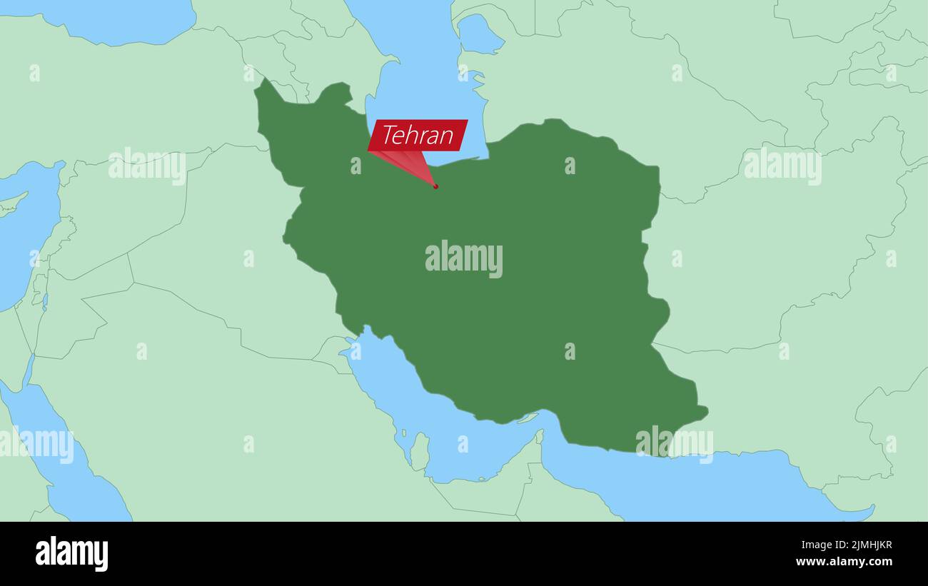
Map of Iran with pin of country capital. Iran Map with neighboring
