Iran's Rugged Heart: Unveiling Its Diverse Topography
Iran, a land steeped in ancient history and rich culture, is defined by its dramatic and varied landscape. At its core, the topography of Iran is a captivating tapestry of rugged, mountainous rims that cradle expansive high interior basins. This unique geographical configuration not only shapes the country's climate and natural resources but also profoundly influences its historical development, population distribution, and geopolitical standing in the Middle East. Understanding Iran's terrain is key to appreciating its resilience and complexity.
From the majestic peaks of the Alborz range in the north to the sprawling plains interspersed within the Zagros Mountains in the west, Iran’s landscape is a testament to powerful geological forces. This article will delve into the intricate details of Iran's topography, exploring its dominant features, their impact on the environment and human settlement, and how this diverse terrain continues to play a pivotal role in the nation's identity.
Table of Contents
- The Dominance of Mountains: Iran's Defining Feature
- Interior Basins and Coastal Contrasts
- Topography's Influence on Climate and Life
- Strategic Location: Geopolitics Shaped by Terrain
- Cities and Settlements: Built on the Landscape
- Natural Resources and Topographical Interplay
- Mapping Iran's Diverse Terrain
- Understanding Iran's Topography: A Journey Through Its Landscape
The Dominance of Mountains: Iran's Defining Feature
The very essence of Iran's physical geography is its mountainous character. Iran's topography is diverse and dominated by rugged mountain ranges, which define much of its landscape. These ranges act as natural barriers, separating various basins or plateaus from one another, creating distinct ecological and cultural zones across the country. The populous western part of Iran is arguably the most mountainous, featuring prominent ranges such as the Zagros and Alborz mountains. This rugged terrain is not merely a backdrop but an active participant in shaping the nation's identity and its people's way of life.
The sheer scale of these geological formations is impressive. Many peaks in the Zagros and Alborz ranges exceed significant elevations, creating formidable natural defenses and challenging environments for human habitation. The average elevation of Iran is around 5,049 feet (approximately 1,539 meters), underscoring the prevalence of high ground throughout the country. This high average elevation, combined with the presence of towering peaks, contributes to Iran's unique climatic patterns and biodiversity, setting it apart from many of its regional neighbors.
The Mighty Zagros: A Backbone of the Nation
The main mountain chain in Iran is undoubtedly the Zagros Mountains. This colossal range stretches from the northwest to the southeast, effectively bisecting the country. Described as a series of parallel ridges interspersed with plains, the Zagros forms a rugged barrier between Iran's central plateau and the more fertile regions of the southwest. Its immense length and breadth mean that it influences a vast portion of Iran's landmass, dictating river courses, agricultural possibilities, and even historical migration routes.
The peaks within the Zagros are formidable. Many peaks in the Zagros exceed 3,000 metres (9,843 ft) above sea level, with some even surpassing 10,000 feet in elevation. These towering heights contribute to significant variations in local climate and provide crucial water sources through snowmelt, feeding rivers that sustain life in the valleys and plains below. The Zagros Mountains are not just a geographical feature; they are a historical and cultural landmark, home to various ethnic groups and ancient civilizations that have adapted to its challenging yet rewarding environment for millennia.
- Seann William Scott S
- Nicole Kidman Filler
- How Old Is Jonathan Roumie Wife
- Tyreek Hill Height And Weight
- Marietemara Leaked Vids
The Alborz Range and Mount Damavand: Peaks of Distinction
While the Zagros dominates the west, the Alborz Mountains hold sway in northern Iran, running parallel to the Caspian Sea. This range is particularly significant as it hosts Iran's highest point, the majestic Mount Damavand. Mount Damavand, part of the Alborz Mountains, is not only the country’s highest peak but also Asia’s highest volcano, with an elevation above sea level of 5,609.2 meters (18,403 feet), though some sources cite it as 5,671 m (18,606 ft). Its snow-capped cone is a prominent landmark, visible from Tehran on clear days, symbolizing Iran's natural grandeur.
The Alborz range, with Damavand as its crown jewel, plays a critical role in Iran's climate by blocking moisture from the Caspian Sea, leading to a stark contrast between the lush northern slopes and the arid interior plateau. This mountain range is also a vital source of water for the capital city, Tehran, which is set against its backdrop. The proximity of such a significant mountain range to a major metropolis highlights the intimate relationship between Iran's urban centers and its dramatic topography.
Interior Basins and Coastal Contrasts
Beyond its imposing mountain ranges, the topography of Iran consists of rugged, mountainous rims surrounding high interior basins. These basins are essentially vast, often arid, plains or plateaus that form the heart of the country, ringed by the formidable mountain chains. This geological structure creates distinct climatic zones and varied landscapes, from salt deserts to fertile oases.
In sharp contrast to these elevated, often dry interior regions are the coastal regions outside the mountain ring. These narrow strips of land offer entirely different environments, influenced by their proximity to major bodies of water and the protective barrier of the mountains.
High Interior Basins: The Heart of the Plateau
A series of massive, heavily eroded mountain ranges surrounds Iran’s high interior basin. These basins, such as the Dasht-e Kavir (Great Salt Desert) and Dasht-e Lut (Empty Desert), are characterized by extreme temperatures and sparse vegetation. They represent a significant portion of Iran's land area, reflecting the country's overall aridity. Despite their harsh conditions, these basins have historically served as crucial pathways for trade routes and as strategic locations for ancient settlements, often relying on underground water channels (qanats) for survival.
The average elevation of these interior basins is still considerable, contributing to the overall high altitude of the country. This elevation, coupled with the rain shadow effect created by the surrounding mountains, results in the arid to semi-arid conditions that dominate much of central Iran. Understanding these basins is crucial to comprehending the challenges and opportunities presented by Iran's unique topography.
Coastal Strips: The Caspian and Persian Gulf
In sharp contrast to the arid interior are Iran's two significant coastal regions. In the north, a strip 400 miles (650 km) long borders the Caspian Sea. This region, never more than a few kilometers wide, is characterized by its lush greenery, high humidity, and abundant rainfall, a stark departure from the central plateau. The Alborz Mountains act as a formidable barrier, trapping moisture from the Caspian Sea and creating a subtropical climate ideal for agriculture, including rice paddies and tea plantations.
To the south, Iran boasts an extensive coastline along the Persian Gulf and the Gulf of Oman. This region, though generally hot and humid, is less fertile than the Caspian coast but is strategically vital due to its access to international shipping lanes and vast oil and gas reserves. The Strait of Hormuz, a narrow waterway connecting the Persian Gulf to the open ocean, is a globally critical chokepoint, underscoring the geopolitical significance of Iran's southern topography.
Topography's Influence on Climate and Life
Iran’s terrain, with its mountains, valleys, and plains, greatly influences the country’s climate, leading to variations in temperature, precipitation, and weather patterns. This direct correlation means that understanding the topography is essential for comprehending Iran's diverse climatic zones. The high mountain ranges act as significant climatic dividers, creating rain shadows and distinct microclimates.
For instance, the Alborz Mountains block moisture from the Caspian Sea, leading to the lush, humid climate of the Caspian littoral and the arid conditions of the central plateau just a short distance away. Similarly, the Zagros Mountains influence precipitation patterns in the west, creating more fertile valleys where agriculture can thrive, contrasting with the drier regions further east. This topographical control over climate directly impacts agricultural practices, water availability, and even the distribution of Iran's population, as people tend to settle in areas with more favorable conditions.
Strategic Location: Geopolitics Shaped by Terrain
The geopolitical position of Iran, with its total area of 1,648,195 square kilometers (636,368 square miles), is deeply intertwined with its topography. Located in the Middle East, between the Persian Gulf in the south and the Caspian Sea in the north, Iran occupies a crucial crossroads. Its land area, approximately 1,531,159 square kilometers (591,349 square miles), is largely defined by its mountainous borders, which have historically provided natural defenses.
Iran shares borders with Pakistan and Afghanistan in the east, Azerbaijan, Armenia, and Turkey in the northwest, and Turkmenistan in the northeast. These land borders, often traversing rugged mountain ranges, have influenced historical invasions, trade routes, and regional power dynamics. The mountainous terrain has made overland travel and military movements challenging, contributing to Iran's strategic depth and resilience throughout history. The control over vital maritime routes through the Persian Gulf further amplifies Iran's geopolitical significance, making its topography a critical factor in regional and global affairs.
Cities and Settlements: Built on the Landscape
The distribution and character of Iran's urban centers and settlements are profoundly shaped by its topography. Major cities are often nestled in valleys, perched on plateaus, or situated at the foothills of mountains, leveraging natural resources and defensive advantages offered by the terrain. Tehran, the capital city, exemplifies this relationship. Located in the northern part of Iran, Tehran is set against the backdrop of the Alborz mountain range, which towers prominently to the north. The city itself is perched at approximately 3,750 feet (1,143 meters) above sea level, providing a striking contrast between its bustling urban sprawl and the majestic peaks that define its northern horizon.
Other cities also reflect this topographical influence. For example, Maku is 22 kilometres (14 mi) from the Turkish border in a mountain gorge at an altitude of 1,634 metres. This demonstrates how human settlements have adapted to and utilized the mountainous terrain, often finding shelter, water, and strategic positions within the folds of the landscape. The challenging topography has also led to the development of unique architectural styles and infrastructure solutions, designed to cope with steep slopes, seismic activity, and varied climatic conditions across different regions.
Natural Resources and Topographical Interplay
Iran's use of natural resources is intricately linked to its topography. The mountainous regions are not only sources of water but also repositories of valuable minerals. The geological processes that formed these vast mountain ranges also led to the creation of significant mineral deposits, including copper, iron ore, lead, zinc, and various precious metals. The rugged terrain, while challenging for extraction, also protects these resources, making their exploration and exploitation a complex but rewarding endeavor.
Furthermore, the varied topography influences the distribution of oil and natural gas reserves, particularly in the southwestern plains adjacent to the Zagros Mountains and offshore in the Persian Gulf. The presence of these vast hydrocarbon reserves, coupled with the strategic geographical location, underpins Iran's economic and political power. Water resources, vital for agriculture and human consumption, are also dictated by the topography; snowmelt from the high peaks feeds rivers and underground aquifers, sustaining life in the interior basins and coastal plains. The management of these resources, especially water in an arid land, is a constant challenge influenced by the country's diverse terrain.
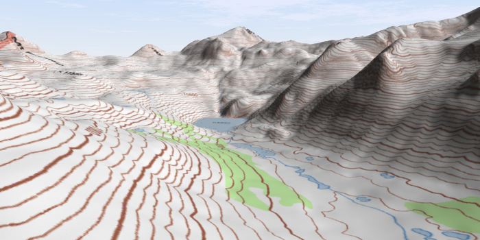
Mapping Iran's Diverse Terrain
Visualizing and understanding Iran's topography is greatly aided by detailed maps. From "Iran at night topography of Iran" satellite images that highlight the mountainous contours under moonlight, to sophisticated topographic maps, these tools are essential for travelers, researchers, and planners. The availability of free topographic maps and digital elevation models (DEMs) at various resolutions, such as 30-meter (1 arc second) or 90-meter (3 arc second), allows for precise measurement of elevation, tracing of geographical features, and calculation of distances and areas.
This part of the site is about map and it has been dedicated to representing different maps of Iran. Since maps are an essential part of a travelers’ equipment and also due to the lack of variety in Iran’s maps, we decided to dedicate a section to this important part of every journey which provides a variety of Iran’s map for different usages and interests. A political map of Iran, for instance, shows Iran and surrounding countries with international borders, the national capital Tehran, province capitals, major cities, main roads, railroads, the highest mountains, major airports, and the location of historical sites like Persepolis, the ancient ceremonial capital of the Achaemenid Empire. These maps are invaluable for navigating the country's complex terrain and appreciating its rich geographical and historical tapestry.
Understanding Iran's Topography: A Journey Through Its Landscape
The topography of Iran is a story written in stone, a narrative of geological forces, climatic variations, and human adaptation. From the towering peaks of the Zagros and Alborz mountains, which form the rugged backbone of the nation, to the expansive, often arid, interior basins and the contrasting fertile coastal strips, Iran's landscape is one of extreme diversity and profound influence. This unique terrain has shaped its climate, dictated the distribution of its natural resources, and played a pivotal role in its geopolitical significance and the very fabric of its society.
Exploring Iran's topography is more than just a geographical exercise; it's a journey into the heart of a civilization deeply intertwined with its land. The challenges and opportunities presented by this varied terrain have forged a resilient people and a rich cultural heritage. We hope this exploration has provided a deeper understanding of the majestic and complex landscape that is Iran. What aspects of Iran's geography do you find most fascinating? Share your thoughts in the comments below, or explore more articles on our site to continue your journey through the wonders of the world's diverse landscapes.
Free Online Sources of Topographic Maps and GIS Data

Two-Minute Takeaway: What is Topography? — The Nature Conservancy in

Topography powerpoint
