Iran Topography: Unveiling A Land Of Mountains And Deserts
Step into the fascinating world of Iran, a nation whose very identity is sculpted by its dramatic landscape. The topography of Iran is a masterpiece of geological forces, a diverse tapestry woven from rugged mountain ranges, vast interior basins, and stark desert expanses. Far from being a uniform land, Iran presents a breathtaking array of geographical features that have profoundly shaped its history, culture, and climate, making it a truly unique corner of our planet.
From the towering peaks that scrape the sky to the shimmering salt deserts that stretch to the horizon, Iran's terrain is a testament to nature's grandeur. This article will take you on an in-depth journey across Iran's varied geographical features, exploring the dominant mountain chains, the expansive central plateau, the crucial lowlands, and how these elements combine to create a landscape of unparalleled diversity and strategic importance. Prepare to discover the intricate details of Iran's topography, a subject that reveals much about this ancient and captivating country.
Table of Contents
- The Majestic Canvas: Understanding Iran's Topography
- The Backbone of Iran: The Zagros Mountains
- Giants of the North: The Alborz Range and Damavand
- The Heart of the Land: Iran's Central Plateau and Deserts
- Life at the Edges: Iran's Lowlands and Coastal Plains
- Elevation and Scale: Iran's Geographic Footprint
- Climate's Tapestry: How Topography Shapes Iran's Weather
- Geopolitical Significance: Topography as a Strategic Asset
- Conclusion: A Land Forged by Mountains and Deserts
The Majestic Canvas: Understanding Iran's Topography
Iran, the 18th largest country in the world, encompasses a vast area of 1,648,195 square kilometers. To put this into perspective, its landmass roughly equals that of the United Kingdom, France, Spain, and Germany combined, or is slightly less than the state of Alaska. This immense size naturally leads to incredible geographical diversity. The overall topography of Iran is characterized by rugged, mountainous rims that encircle high interior basins, creating a distinctive bowl-like structure. This unique geological arrangement is a defining feature of the Iranian plateau, which itself is highly diversified, encompassing not just mountain ranges but also extensive basins and formidable desert areas. Understanding this fundamental structure is key to appreciating the complex interplay of natural forces that have shaped Iran's landscape over millennia. The country's terrain is predominantly rugged, with most of the land situated above 1,500 feet (460 meters), highlighting its elevated nature.The Backbone of Iran: The Zagros Mountains
When discussing Iran topography, it's impossible to overlook the Zagros Mountains. This colossal range is unequivocally the main mountain chain, acting as the very backbone of the country. Stretching from the northwest to the southeast, the Zagros system bisects Iran, creating a formidable natural barrier and defining much of its western and southwestern landscape. This isn't a single, monolithic ridge, but rather a complex series of parallel ridges, often interspersed with fertile plains and deep valleys. The sheer scale of the Zagros is impressive, with many peaks soaring beyond 10,000 feet in elevation, presenting a challenging yet breathtaking terrain.Peaks and Valleys: A Detailed Look at the Zagros
The Zagros range runs along the western edge of Iran, forming a natural boundary and a significant physiographic region. Its structure, characterized by multiple parallel ridges with valleys in between, creates a unique environment. These valleys have historically served as crucial passages for trade and human settlement, while the higher elevations remain wild and sparsely populated. The intricate folding and faulting visible across the Zagros are a geologist's dream, illustrating the immense tectonic forces that have shaped this part of the world. The mountains are not just a physical barrier but also play a vital role in Iran's hydrology, catching moisture from the west and feeding numerous rivers that flow into the Persian Gulf, making them essential for the country's water resources.Giants of the North: The Alborz Range and Damavand
While the Zagros dominate the west, the Alborz mountain range holds sway in the north, forming another critical component of Iran's mountainous rims. The Alborz chain, though not as extensive in length as the Zagros, is home to the country's highest peak, Mount Damavand. This majestic, snow-capped stratovolcano is not only Iran's highest point but also the highest volcano in Asia, reaching an astounding elevation of 5,610 meters (18,406 feet). Damavand stands as an iconic symbol of Iran, visible from afar and a source of national pride. The Alborz range acts as a significant climatic barrier, trapping moisture from the Caspian Sea to its north and creating distinct ecological zones on its northern and southern flanks.Tehran's Mountainous Embrace
The influence of the Alborz is perhaps most vividly seen in the capital city, Tehran. Located in the northern part of Iran, Tehran is dramatically set against the backdrop of the Alborz mountain range, which towers prominently to the north. The city itself is perched at approximately 3,750 feet (1,143 meters) above sea level, providing a striking contrast between urban sprawl and the towering natural beauty. This close proximity to the mountains offers Tehran residents access to ski resorts and hiking trails, but also influences the city's climate and air quality. The rugged terrain extends right to the city's edge, illustrating how deeply Iran's topography is integrated with its urban centers. Further west, towns like Maku, situated in a mountain gorge at an altitude of 1,634 meters (approximately 5,361 feet) and just 22 kilometers (14 miles) from the Turkish border, further highlight the pervasive mountainous character of Iran's border regions.The Heart of the Land: Iran's Central Plateau and Deserts
Nestled within the protective embrace of Iran's surrounding mountain ranges lies the vast Central Plateau, a defining feature of Iran topography. This elevated expanse, with an average elevation of 5,049 feet, forms the core of the country. While it might seem uniform from a distance, the plateau is far from monotonous. It is a highly diversified topographical area, encompassing not only relatively fertile plains but also, most notably, two large and formidable salt deserts: the Dasht-e Kavir and the Dasht-e Lut. These deserts are stark reminders of the arid conditions prevalent in much of the interior, shaped by the rain shadow effect of the surrounding mountains.The Silent Wonders: Dasht-e Kavir and Dasht-e Lut
The Dasht-e Kavir, or "Great Salt Desert," is located in the north-central part of the Iranian plateau. It is characterized by salt marshes, mudflats, and salt lakes, making it one of the most inhospitable places on Earth. Its extreme aridity and high salt content limit vegetation and make travel exceptionally difficult. To the southeast lies the Dasht-e Lut, or "Empty Desert," which is even more extreme. Known for its towering sand dunes (some of the world's tallest) and its reputation as one of the hottest places on Earth, the Dasht-e Lut is a truly desolate yet awe-inspiring landscape. These two vast salt deserts are critical components of Iran's unique geological features, representing the extreme end of its topographical diversity and playing a significant role in the country's overall climate patterns.Life at the Edges: Iran's Lowlands and Coastal Plains
Despite its predominantly mountainous and elevated terrain, Iran does possess two significant expanses of lowlands, which offer a stark contrast to the rugged interior. These low-lying areas are crucial for agriculture, population centers, and access to international waters, illustrating another facet of Iran's diverse topography.The Fertile Crescent: Khuzestan Plain
In the southwest, bordering the Persian Gulf and Iraq, lies the Khuzestan Plain. This is a vital agricultural region, historically known as a "fertile crescent" due to its rich alluvial soils deposited by rivers flowing from the Zagros Mountains, such as the Karun River. The Khuzestan Plain is one of Iran's most important oil-producing regions, making it economically significant. Its low elevation and proximity to the Persian Gulf give it a distinct hot and humid climate, differing greatly from the arid plateau or the mountainous regions.Caspian Shores: A Unique Ecosystem
To the north, along the shores of the Caspian Sea, stretches the Caspian Sea Coastal Plain. This narrow strip of land is Iran's other significant lowland area. Unlike the arid Khuzestan, the Caspian plain is characterized by lush, subtropical vegetation, high humidity, and abundant rainfall, thanks to the moisture trapped by the Alborz Mountains. This region is a vital agricultural area, famous for its rice paddies, tea plantations, and citrus groves. It also hosts significant wetlands, which are crucial for migratory birds, though some of Iran's lakes, like the once-vast Lake Urmia in the northwest, have faced significant challenges, including shrinking due to environmental factors and human activity, highlighting the delicate balance of Iran's water bodies.Elevation and Scale: Iran's Geographic Footprint
Iran's topography is defined by its remarkable elevation. As previously noted, most of the country's land lies above 1,500 feet (460 meters), and the average elevation across the entire nation is approximately 5,049 feet. This high average elevation underscores the pervasive influence of its mountain ranges and plateaus. From the peaks surpassing 10,000 feet in the Zagros to the high-altitude setting of cities like Tehran, the elevated nature of the terrain is a constant. The country's vast size, at 1,648,195 square kilometers, combined with its dramatic changes in elevation, means that mapping and visualizing its geographical features are essential for understanding its complexities. Topographic maps, often available at various resolutions (e.g., 30m, 3 arc second, 30 arc second), are invaluable tools for illustrating the intricate contours, water bodies, and elevation changes across Iran, providing crucial information for everything from environmental studies to travel planning.Climate's Tapestry: How Topography Shapes Iran's Weather
The topographical diversity of Iran is directly responsible for its wide range of climates. This is a critical aspect of Iran topography, as the mountains, basins, and desert areas create distinct microclimates across the country. For instance, the high Alborz mountains block moisture from the Caspian Sea, leading to a humid subtropical climate along the northern coast, while just a short distance south, the Central Plateau experiences an arid climate. The Zagros Mountains also play a significant role, creating cool and subhumid conditions in their higher elevations and semi-arid climates in their intermontane plains. This means that within Iran, one can encounter everything from cold semi-arid conditions in the mountainous northwest to hot, arid desert climates in the central regions, and humid subtropical conditions along the Caspian coast. This climatic variety impacts everything from agricultural practices and water resource management to population distribution and daily life across the nation.Geopolitical Significance: Topography as a Strategic Asset
Iran's geopolitical position is inextricably linked to its topography. Located in the Middle East, between the Persian Gulf in the south and the Caspian Sea in the north, its mountainous rims and vast interior basins have historically provided natural defenses and shaped its interactions with neighboring countries. The Zagros Mountains, for example, form a rugged western frontier, while the Alborz protect the northern heartland. Iran shares borders with Pakistan and Afghanistan to the east, Azerbaijan, Armenia, and Turkey to the northwest, and Turkmenistan to the northeast. These land borders, often traversing challenging mountainous or arid terrain, have influenced trade routes, military strategies, and cultural exchanges throughout history. The Strait of Hormuz, a critical maritime choke point, is also influenced by the coastal topography of Iran and Oman, underscoring the strategic importance of Iran's geographical features on a global scale. This complex interplay of landforms has made Iran a pivotal player in regional dynamics for centuries.Conclusion: A Land Forged by Mountains and Deserts
The topography of Iran is a story of contrasts and extremes, a magnificent blend of towering mountains, expansive plateaus, and vital lowlands. From the formidable Zagros Mountains that bisect the country to the iconic peaks of the Alborz, and from the parched salt deserts of the interior to the lush Caspian shores, Iran's landscape is as diverse as it is dramatic. This rich geographical tapestry has not only shaped the country's climates and ecosystems but has also profoundly influenced its historical development, strategic importance, and the very character of its people. Understanding Iran's topography is to understand the very essence of this ancient land. It's a land where geological forces have carved out a unique and breathtaking canvas, inviting exploration and appreciation. We hope this journey through Iran's diverse terrain has offered valuable insights into its remarkable natural heritage. What aspect of Iran's geography do you find most intriguing? Share your thoughts in the comments below, or explore more of our articles to delve deeper into the wonders of our world!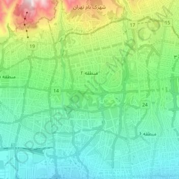
District 2 topographic map, elevation, terrain
District 3 topographic map, elevation, terrain
District 3 topographic map, elevation, terrain
