Iran's Geographic Location: A Crossroads Of History & Culture
The geographic location of Iran is undeniably one of its most defining characteristics, positioning it as a pivotal nation in West Asia. This strategic placement, nestled between vital waterways and bordering numerous countries, has profoundly shaped its history, culture, climate, and geopolitical significance. From ancient empires to modern-day dynamics, Iran's physical setting has consistently placed it at the heart of regional and global affairs.
Far more than just lines on a map, the intricate details of Iran's geography paint a vivid picture of a land of contrasts and enduring influence. Bounded by the vast Caspian Sea to the north and the crucial Persian Gulf and Gulf of Oman to the south, its access to both northern and southern maritime routes is a testament to its enduring importance. This article delves deep into the multifaceted aspects of Iran's geographic location, exploring its physical landscape, intricate borders, climatic patterns, and the indelible mark these features have left on its rich civilization.
Unveiling Iran's Strategic Position in West Asia
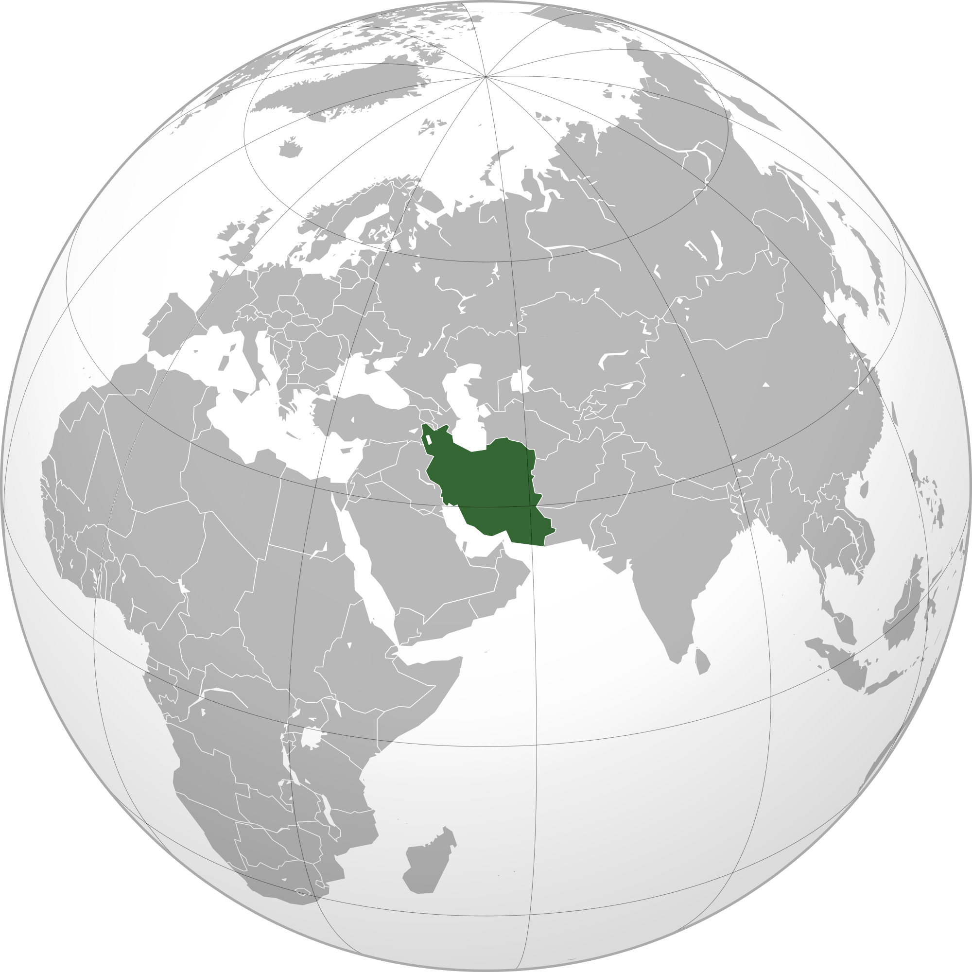
Geographically, the country of Iran is located in West Asia, a region renowned for its historical depth and contemporary geopolitical importance. Formally known as the Islamic Republic of Iran, its placement in this vital part of the world is no accident; it has historically served as a bridge connecting East and West, influencing trade, culture, and power dynamics for millennia. This central position in Western Asia means that Iran acts as a crucial land bridge between the Middle East, the Caucasus, Central Asia, and the Indian subcontinent, making its geographic location a constant factor in regional stability and international relations.
Its strategic importance is further amplified by its proximity to major energy reserves and critical shipping lanes, particularly in the Persian Gulf. This unique positioning has meant that Iran has long been a focal point for empires and global powers, a tradition that continues to this day. The interplay of its physical attributes—from towering mountain ranges to vast arid plains—with its strategic location creates a complex and fascinating mosaic that is central to understanding the nation.
A Tapestry of Borders: Iran's Neighbors and Coastlines
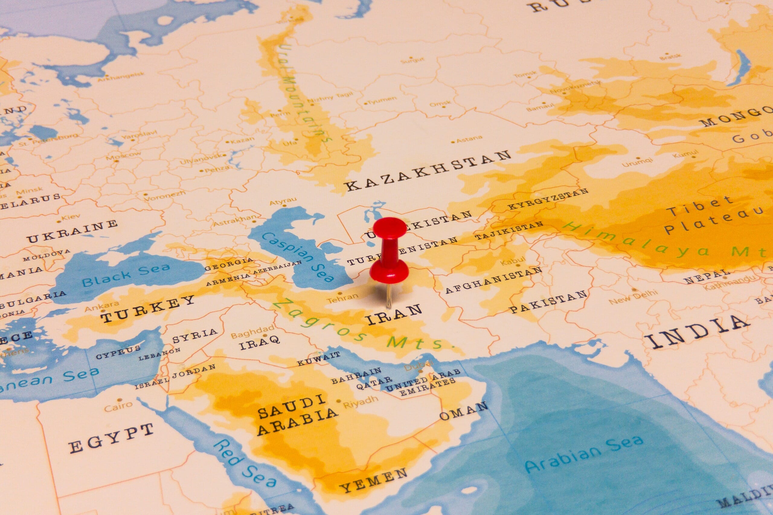
The geographic location of Iran is defined not only by its internal landscapes but also by its extensive and diverse borders. Iran occupies a vast area of 1,648,195 square kilometers in southwestern Asia, making it the 17th largest country in the world. This expansive territory shares land borders with an impressive array of seven different countries, each contributing to its intricate geopolitical tapestry.
To the north, Iran shares borders with Armenia (936 km or 582 mi), Azerbaijan (a complex border totaling 35 km or 22 mi across two separate segments), and Turkmenistan (499 km or 310 mi). These northern frontiers connect Iran to the Caucasus and Central Asian regions, facilitating historical and contemporary exchanges. To the east, Iran is bordered by Afghanistan (909 km or 565 mi) and Pakistan (1,458 km or 906 mi), linking it to South Asia and the broader Indian subcontinent. In the west, its neighbors are Iraq (432 km or 268 mi) and Turkey (499 km or 310 mi), which connect Iran to the Levant and Europe.
Beyond its land borders, Iran’s geographic location is significantly shaped by its extensive coastlines. The Caspian Sea defines its northern boundary, a vast inland sea that holds significant ecological and economic importance. To the south, Iran is bounded by the strategically vital Persian Gulf and the Gulf of Oman, providing crucial access to international waters and global trade routes. These bodies of water—the Caspian Sea, Persian Gulf, and Gulf of Oman—are integral to Iran's economic activities, particularly in energy exports, and its regional maritime influence.
Iran's Diverse Terrain: Mountains, Deserts, and More
What is the terrain and geography like in Iran? The answer reveals a captivating blend of diverse landscapes and natural features. Iran is fundamentally a mountainous, arid, and ethnically diverse country of southwestern Asia. This geographical diversity is a defining characteristic, presenting a wide range of environments from snow-capped peaks to vast desert basins and even fertile plains.
The country is surrounded by several prominent mountain ranges that dominate its topography. These include the majestic Alborz Mountains in the north and the extensive Zagros Mountains stretching across its west and southwest. These ranges act as natural barriers, influencing climate patterns, population distribution, and historical movements. Beyond the mountains, Iran's landscape transitions into vast desert areas, most notably the Dasht-e Kavir (Great Salt Desert) and the Dasht-e Lut (Empty Desert), which are among the hottest and most arid regions on Earth. Yet, amidst this aridity, there are also fertile basins and forested areas, particularly along the Caspian Sea coast, which receive significant rainfall and support lush vegetation. This remarkable blend of mountains, deserts, and forests creates a truly unique and varied geographical profile.
The Majestic Alborz and Zagros Ranges
The Alborz and Zagros mountain ranges are the geological backbone of Iran, playing a pivotal role in shaping its climate, ecology, and human settlement patterns. The Alborz range, running across northern Iran, is home to Mount Damavand, the highest peak in Iran and the Middle East, an imposing volcanic cone that reaches over 5,600 meters. This range acts as a significant barrier, trapping moisture from the Caspian Sea and leading to the lush, humid climate of the Caspian littoral plain, a stark contrast to the arid interior. The Zagros Mountains, on the other hand, stretch for over 1,500 kilometers from the northwest to the southeast of Iran, forming a rugged and formidable barrier. These mountains are rich in minerals and have historically provided natural defenses, shaping the distribution of ethnic groups and the development of distinct regional cultures. Both ranges are crucial for Iran's water resources, serving as sources for many of the country's rivers and contributing to its agricultural potential in their valleys and foothills.
Arid Landscapes and Fertile Basins
While the image of Iran often conjures up vast deserts, the reality is a nuanced interplay between arid landscapes and surprisingly fertile basins. The central plateau of Iran is dominated by two immense desert regions: the Dasht-e Kavir and the Dasht-e Lut. These areas are characterized by extreme temperatures, salt flats, and sand dunes, making them largely uninhabitable. However, interspersed within and around these arid zones are numerous oases and fertile basins, often fed by seasonal rivers originating from the surrounding mountains. These basins, such as the one where Tehran is located, have historically been crucial for agriculture and human settlement. The varying elevations and the presence of mountain-fed rivers allow for diverse agricultural practices, from date palm cultivation in the warmer south to wheat and barley farming in more temperate regions. This complex mosaic of barren deserts and productive agricultural lands highlights the remarkable adaptability of Iranian civilization to its challenging yet rewarding geographic location.
The Influence of Water Bodies: Caspian Sea to Persian Gulf
The bodies of water the nation borders are the Caspian Sea, Persian Gulf, and Gulf of Oman, each exerting a profound influence on Iran's economy, climate, and strategic outlook. To the north, the Caspian Sea, the world's largest inland body of water, borders Iran. This sea is not only a source of fish, particularly caviar, but also holds significant hydrocarbon reserves and serves as a vital waterway for trade with Russia and Central Asian states. The Caspian Sea's presence also contributes to the unique, humid climate of Iran's northern provinces, distinguishing them sharply from the country's arid interior.
To the south, Iran's long coastline along the Persian Gulf and the Gulf of Oman is arguably even more strategically critical. The Persian Gulf is a major artery for global oil trade, with a significant portion of the world's crude oil passing through its waters. Iran's control over a substantial part of its northern shore gives it immense leverage in regional and international energy markets. The Strait of Hormuz, a narrow passage connecting the Persian Gulf to the Gulf of Oman and then to the Arabian Sea, is one of the world's most vital choke points for oil shipments. The Gulf of Oman, less enclosed than the Persian Gulf, provides Iran with direct access to the Indian Ocean and beyond, facilitating maritime trade and naval operations. The economic and strategic importance of these southern waters cannot be overstated, as they are central to Iran's global connectivity and its role in energy geopolitics.
Climate Dynamics Shaped by Geographic Location
The special geographic location of Iran profoundly affects its climate condition, resulting in a remarkable diversity of weather patterns across the country. Iran's climate is largely characterized by extremes, ranging from the humid subtropical conditions along the Caspian Sea to the arid and hyper-arid climates of its central plateau and southern regions, and the cold, snowy winters in its mountainous areas.
As a result, the weather condition of Iran is stable in summer, when it is predominantly under the influence of subtropical high pressure, leading to hot, dry, and clear skies across much of the country. This high pressure system suppresses cloud formation and precipitation, contributing to the widespread aridity. In contrast, Iran's climate becomes unstable in winter, when it is under the influence of extratropical atmospheric systems. These systems bring colder air masses, and depending on their trajectory, can result in significant rainfall or snowfall, particularly in the western and northern mountainous regions. The Alborz and Zagros mountains play a crucial role in shaping these patterns, acting as barriers that capture moisture from incoming air masses, leading to localized heavy precipitation on their windward slopes and creating rain shadows on their leeward sides, thus contributing to the desertification of the interior. This interplay of high-pressure systems, extratropical influences, and diverse topography creates a climate that is as varied and complex as Iran's geography itself.
Tehran: The Heart of Iran's Geographic and Cultural Landscape
At the very core of Iran's vast and varied landscape lies Tehran, its bustling capital and largest city. The geographic location of Tehran is marked at latitude 35.6892° N and longitude 51.3890° E, placing it strategically at the foothills of the Alborz Mountains in the north-central part of the country. This location is significant not only for its administrative and economic functions but also for its representation of Iran's diverse geography and population. With a population of over 86 million people nationwide, Tehran serves as the vibrant hub for a significant portion of this populace, drawing people from across the country's diverse ethnic and linguistic groups.
Tehran's position at the crossroads of major transportation routes, connecting the northern regions to the central plateau and beyond, underscores its importance. Its proximity to the Alborz Mountains provides a cooler climate and recreational opportunities, while its connection to the central plains facilitates agricultural and industrial activities. As the political, economic, and cultural heart of the Islamic Republic, Tehran embodies the complexities and dynamism of Iran's geographic and human landscape. While the official language of Iran is Persian, and its currency is the Iranian Rial, Tehran itself is a microcosm of the nation's rich tapestry, influenced and shaped by the very geographical features that define the country.
Historical Echoes: How Geography Forged a Civilization
The geography of Iran is a captivating blend of diverse landscapes and historical significance, demonstrating how its physical attributes have played a pivotal role in shaping its history and cultural identity. The Iran of today stands upon an ancient base of civilization and culture. Long a crossroads for conquerors, it has been known in the West as Persia since the beginnings of historical records associated with Cyrus the Great in the 6th century B.C.E. This enduring legacy is deeply intertwined with its geographic location.
The heart of the Persian Empire of antiquity, Iran has long played an important role in the region as an imperial power and as a factor in superpower rivalries. Its central position made it a coveted territory for various empires, from Alexander the Great, who brought Hellenistic culture to Persia in the 4th century B.C.E. and opened the gate to a long procession of foreign dynasties, to later Islamic caliphates and beyond. Despite these waves of foreign influence, Iran has maintained a rich and distinctive cultural and social continuity dating back to the Achaemenian period, which began in 550 BCE. Modern Iranian culture owes itself in part to a renaissance in the 8th century, further solidifying its unique identity. Since 1979, it has become known for its unique brand of Islamic Republic, a testament to its continued evolution while retaining its historical roots. Iran has a rich history and culture, inextricably linked to its geographical resilience and strategic importance.
A Crossroads of Empires and Trade Routes
Iran's geographic location has inherently positioned it as a vital crossroads for empires, trade routes, and cultural exchange throughout history. Situated at the intersection of Europe, Asia, and Africa, it became a natural corridor for ancient Silk Road trade routes, facilitating the movement of goods, ideas, and technologies between East and West. This central role, while bringing immense prosperity and cultural enrichment, also made Iran a frequent target for invaders. Its vast plains and accessible mountain passes invited conquerors from various directions, leading to a long history of foreign dynasties. Yet, each conquest, while leaving its mark, often assimilated into the existing Persian cultural framework, demonstrating the resilience and absorptive capacity of Iranian civilization. This constant interplay between external forces and internal cultural strength is a direct consequence of its pivotal geographical placement.
Cultural Continuity and Geographic Resilience
Despite centuries of invasions and foreign rule, Iran has maintained a remarkable degree of cultural continuity, a phenomenon significantly aided by its geography. The country's rugged mountain ranges and vast deserts often served as natural fortresses, providing refuge for local populations and allowing distinct cultural practices and languages to endure. While conquerors might control the fertile plains and urban centers, the more remote and mountainous regions often preserved older traditions and forms of resistance. This geographic resilience enabled the "Persian" identity to persist, even as political power shifted hands. The ability to absorb and integrate foreign influences while retaining a core cultural identity is a hallmark of Iranian history, a testament to how its diverse and often challenging terrain fostered a deep-rooted sense of nationhood that transcended political boundaries and external pressures. This enduring cultural legacy is a direct reflection of how Iran's unique geographic location has shaped its people and their civilization over millennia.
Understanding Iran's Global Significance Through its Geography
The profound impact of the geographic location of Iran extends far beyond its historical narrative, playing a critical role in its contemporary global significance. Its position in West Asia, bordering the Caspian Sea to the north and the Persian Gulf and Gulf of Oman to the south, inherently places it at the nexus of major energy resources and international trade routes. This strategic importance is a key factor in geopolitical considerations, making Iran a focal point in discussions about regional stability and global energy security.
The country's extensive borders with multiple nations, from the Caucasus to South Asia, also underscore its role as a regional power and a bridge for various cultural and economic interactions. Understanding Iran's complex foreign relations, including issues like its nuclear program or its stance on regional dominance, often requires appreciating the strategic advantages and vulnerabilities presented by its geography. For instance, Israel's determination to keep Iran from nuclear weapons and regional dominance, while Iran frames resistance to Israel as central to its revolutionary identity, is fundamentally influenced by the perceived strategic implications of Iran's geographic reach and capabilities. In essence, Iran's physical map is a living blueprint of its past, present, and future trajectory on the world stage, making its geography an indispensable element for anyone seeking to comprehend its enduring influence.
Conclusion
In conclusion, the geographic location of Iran is not merely a set of coordinates on a map; it is the fundamental cornerstone of its identity, history, and strategic importance. From its pivotal position in West Asia, connecting diverse regions and cultures, to its complex tapestry of mountains, deserts, and crucial waterways, Iran's physical attributes have profoundly shaped its journey through time. Its extensive borders with seven nations and its vital access to the Caspian Sea, Persian Gulf, and Gulf of Oman underscore its enduring role as a regional crossroads and a significant player in global energy and geopolitical landscapes.
The interplay of its diverse terrain with its unique climate patterns has fostered a resilient civilization that has maintained a rich and distinctive cultural continuity for millennia. Understanding Iran's past and present, from the ancient Persian Empire to its modern Islamic Republic, is impossible without appreciating the indelible mark left by its geography. We hope this comprehensive exploration has provided valuable insights into the multifaceted significance of Iran's geographical position. We invite you to share your thoughts in the comments below or explore other articles on our site to deepen your understanding of this fascinating region.
- Arikysta Leaked
- Arikytsya Of Leaks
- King Nasir Real Name
- Faith Jenkins Net Worth 2024
- Images Of Joe Rogans Wife
Where is Iran? 🇮🇷 | Mappr
Location of the Iran in the World Map

Iran geographic map : MapsPorn
